By Ahyousha Khan
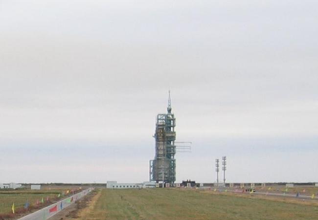
Earlier this July, Pakistan launched two satellites from China’s Jiuquan Satellite Centre. Pakistani official from MOFA confirmed the launching of satellites named – PRSS-1 and Pak-TES-1A. PRSS-1 is 1200 kg satellite which has the capacity to operate at an altitude of 640 kilometers. On the other hand Pak-TES-1A is 285 kg satellite accessorized with optical payload that can fulfill the national needs.
These satellites will enable Pakistan to meet its requirements of land mapping and natural disaster management through imagery. Pakistan used China’s assistance in launching its indigenous satellite because it yet has to master the technology in launching vehicle. Satellites assigned for geographical mapping work in polar orbit, which means that they are not geostationary satellites rather satellites pass over both poles with an inclination of 90 degrees to the body’s equator. Satellite on its each rotation to observe the earth passes over the equator at different longitude.
The recent space launch of Pakistan is through the support given by Asia Pacific Space Cooperation Organization (APSCO), which is an institute functioning as independent, non-profit organization between governments of different countries with full legal power. Its members are from states like Pakistan, Bangladesh, Mangolia, Peru, Thailand, Indonesia and Turkey. In the backdrop of this collaboration future cooperation between Pakistan, China and APSCO will be further strengthened.
Satellites Pakistan sent in space are earth observational and optical satellites, which would allow Pakistan space agency SUPARCO to analyze its imagery requirements which involves land mapping, crops assessment and rural and urban planning. Moreover, it will also enable Pakistan to observe land and forest degradation, effects of climate change, melting of glaciers, heavy flooding and will allow Pakistan to manage its resources and disasters more effectively.
Pakistan is a state which is disaster prone and is becoming victim of heavy flooding quite regularly. Moreover, fresh water resources are rapidly depleting across the country. Thus, in such circumstances satellite with earth mapping capability is truly a blessing which could enable Pakistan to counter its issue of water management more effectively. It is important for country like Pakistan that is based upon agrarian economy to manage its natural resources as effectively as it could. Thus, rapid and slow changes in geography of a country with potential to effect will be easily observed and timely managed through the help of remote sensing satellite.
Pakistan is a state where population is growing rapidly. Thus, there is a need of a lot of rural and urban planning as unplanned cities and towns will be prone to natural calamities and basic facilities will not be available to them. However, this problem can also be controlled and managed with properly organized rural and urban mapping and thus PRSS-1 could play an important role in it.
Although these satellites are not part of CPEC project but they could play significant role in geographical mapping of the areas under the China Pakistan Economic Corridor project (CPEC) and would keep planners updated regarding the changes in geographical structures. Thus, would enable them to make environmental safe projects for the longer benefit. Although Pakistan is committed to use these particular satellites for socio-economic benefits but future venture of remote sensing satellites could also enable Pakistan to keep an eye on extremely porous Pak-Afghan border, which could help the country in identifying terrorist movement and consequently in eliminating the terrorism from not only Pakistan but from the region.
Development of both satellites by Pakistani scientists is indeed commendable but it is to be acknowledged that the dream to go beyond infinity would not have become a reality without China’s help. States should and must reach new avenues like space and was high time for Pakistan to launch its satellite because its regional rival has already began the weaponization of Space by placing three designated naval, one military satellite in space.
However, self-sufficiency is equally important as successful nations do not go beyond infinity without self-sufficiency. So far, the biggest challenge for Pakistan in its way to achieving self-sufficiency in space technology is lack of launch vehicle, which needs an immediate focus by the scientists and researchers.
It is also the responsibility of government of Pakistan to spend more on space technology as space satellites are not just the eye in the sky, which help observe and monitor but are also enabling our communications around the globe, thus, performing the role of ears in sky as well.
Ahyousha Khan is a Research Associate at the Strategic Vision Institute in Islamabad, Pakistan


