China and the new maritime cartography
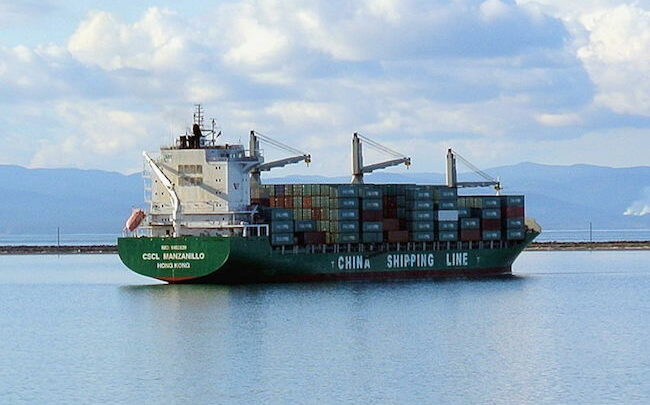
Maritime transport currently represents 95% of everything transported in the world, two-thirds corresponding to oil and mineral traffic and container ships being a fifth of the total. The mega containers would have become essential elements to maintain the feverish export capacity of China, the Asian tigers or the European Union since they combine the capacity to transport about 800 million tons and is much less polluting than air transport and by road, although it would be threatened by the stratospheric rise in the cost of freight due to the current collapse of the post-pandemic freight traffic.
China and the obstacle course of current maritime cartography
From the economic point of view, the Arctic region takes on a special relevance since due to the progressive thawing, an old navigable route is recovered that opens the possibility of crossing the Northwest Passage all year round. In addition, it offers shipping companies a considerable reduction in navigation times that will have as collateral effects the progressive decrease in maritime traffic on the traditional maritime routes of the 20th century, which has become a complicated obstacle course due to traffic saturation and political instability of the surrounding countries and which would have as main landmarks the Suez Canal, the Gulf of Aden, the Strait of Hormuz and the Strait of Malacca
The passage of the Suez Canal is considered one of the most important points for world trade since it transports 2.6 million barrels of crude oil per day (which represents almost 3% of the daily world demand for oil) and is also a relevant route for liquefied natural gas (LNG), since about 13% of the world production of this gas traveled through it in 2010 and its hypothetical closure would cause the interruption of the supply of around 2.6 million barrels per day. Likewise, it would be an essential route for the US Navy, since until now Egypt granted the US Navy expeditious passage through the Suéz Canal for the approximately 40 warships that cross said channel on a monthly basis. it ensured a crucial shortcut for direct access to the United Arab Emirates, Iraq and Afghanistan, turned into an unstable area due to the possibility of jihadist attacks.
For its part, the Gulf of Aden is a strategic place that connects the Indian Ocean with the Mediterranean Sea through the Suez Canal, with a transit of more than 18,000 ships according to official statistics cited by the Bulgarian economic daily, Capital. However, and although warships belonging to more than ten countries patrol the waters of the Gulf of Aden, the countries that border it suffer from political stability, which is why there are numerous cases of piracy and even terrorist attacks, of which it would be a paradigm the attack on the warship USS Cole, thus having become an unsafe route.
Furthermore, a blockade of the Strait of Hormuz, through which one third of the world’s energy traffic passes, could exacerbate the global economic recession and profoundly weaken the entire international political system. Thus, according to estimates by the IEA (International Energy Agency), 13.4 million barrels per day (bpd) of crude would pass through the narrow channel in oil tankers, (which would represent 30% of the crude supply that is traded worldwide) and if the passage through said strait collapses, we would witness a psychosis of shortages and a spectacular increase in the price of crude oil to 2008 levels (around $ 150), which would be reflected in a wild increase in freight prices. transport and agricultural fertilizers.
Continuing the route to the Asian countries, the Strait of Malacca (between Singapore and Malaysia) is a narrow corridor 800 kilometers long and a minimum width of 2.8 kilometers that connects the Indian Ocean with the China Sea and is considered one of the main areas of international maritime traffic between Asia and Europe. Thus, this strait supports three times more traffic than other maritime corridors since Southeast Asia concentrates most of the world’s merchandise and both China and Japan use it to supply oil and since the passage of the Strait of Malacca would have become “ de facto ”in a sea lane saturated and affected by pirate attacks, China would have started the work of the channel of the Isthmus of Kra to bypass them.
Likewise, China would be building an extensive port network, which would include ports, bases and observation stations in Sri Lanka, Bangladesh and Burma and of which it would be a paradigm, the strategic port in Pakistan, Gwadar, (the “gorge” of the Persian Gulf), 72 kilometers from the border with Iran and about 400 kilometers from the most important oil transportation corridor and very close to the strategic Strait of Hormuz. The port was built and financed by China and is operated by the state-owned China Overseas Port Holding Company (COPHC), since the region surrounding the port of Gwadar contains two-thirds of the world’s oil reserves and 30 percent passes through there. of the world’s oil and 80 percent of that received by China and is on the shortest route to Asia (Silk Road).
Arctic route
According to the president of the Academy of Geopolitical Problems Leoníd Ivashov in statements to KM.RU. “The Northern Sea Route is freed of ice, making it more navigable and reducing cargo traffic in the eastern hemisphere by thousands of kilometers, making the Arctic an important geopolitical region.” Thus, according to an analysis by the columnist of the Odnako portal, Alexánder Gorbenko, “the northern sea route (linking the Atlantic and the Pacific along the coasts of Russia) is considered an alternative to the Suez Canal and the Panama Canal. , which could make it one of the most important commercial corridors in the world in the near future ”. The Northern Sea Route and the Northwest Passage are sea lanes along the edges of the Arctic Ocean (more precisely along the northern coasts of Canada and Russia) and combine the ability to provide a means for transportation of natural resources (oil and gas) extracted in the Arctic as well as a notable reduction in the duration of the journey of goods shipments from the Pacific to the Atlantic coasts of Europe and North America (this new route would save 7,400 miles of the 11,500 that currently have to be used to link Hamburg and Yokohama).
According to buricapress (BPP), during the first decade of the 21st century, interest in maritime transport between Europe and Asia through the Arctic Ocean would have increased, due to the massive thaws that have opened the route of the “Ocean of Ice” and in In the summer of 2009, two German transport ships used the North Sea Route without the aid of icebreakers. On the Russian side, on August 14, 2010, the first high-tonnage tanker left Russian ports taking the North Sea Route towards Asia and reaching Pevek on the Chukotka Peninsula and likewise, in the fall of 2010 the first shipment of Iron was shipped from Kirkenes, Norway to China via the North Sea Route and China sent a merchant ship to Europe for the first time through the Northeast Passage and access to the Arctic would have been secured after the signing with Iceland of a TLC while Canada is also preparing for a significant increase in the use of the Northwest Arctic route.
Post-Panamax and Short Sea Shipping (TMCD)
The Panama Canal is an artificial canal inaugurated on August 15, 1914 and which meant a milestone in maritime transport by joining the Atlantic and Pacific oceans and avoiding circumventing Cape Horn, with an estimated traffic through its system of locks of more of 14,000 ships and a cargo of 300 million tons per year (5% of world trade), according to data from the Panama Canal Authority. However, the traffic figures in recent years suffered from constant deterioration as the Suez Canal would have taken away part of its natural market segment, so the inauguration of the new expanded Panama Canal will serve as a catalyst to recover the market. lost. Thus, after seven years of technical and financial setbacks, the consortium of companies led by Sacyr (GUPC) has concluded the expansion of the Third Set of Locks of the Panama Canal, a pharaonic work that will represent a milestone in civil engineering as well as a an authentic revolution in maritime navigation of the XXI century by allowing the transit of freighters of more than 400 meters in length and 50 meters in width (the so-called post-Panamax) capable of transporting up to 12,500 containers in a single trip, taking about 18 hours to link the Atlantic and the Pacific, which will translate into an increase in cargo transported to 600 million tons per year (10% of world trade) as well as an important source of income for Panama estimated at $ 19 million per day.
In addition, in the next decade we will see the implementation of new Motorways of the Sea in Short Distance Maritime Transport (TMCD) that would be alternatives for the transport of passengers and commercial cargo that uses inland and coastal waterways with the unequivocal objective of reducing costs. and pollution and of what would be a paradigm of the port of Bilbao, leader in Medium and Short Distance Transport on the Atlantic coast. This, together with the foreseeable boom of the Arctic Route and the new Panama Canal, will end up causing a true tsunami in the current global maritime architecture, as new maritime corridors emerge that will offer shipping companies a considerable reduction in shipping times. This navigation will ultimately result in a progressive decrease in maritime traffic due to the unstable and saturated maritime routes of the 20th century, but which will have to overcome the current collapse of post-pandemic freight traffic to offer competitive freight rates.